|
Science Update: The Carrying Capacity of Mudflats
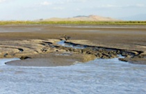 Mudflats, also called shoals or tidal flats, are a very visible feature of the far South Bay environment and they serve an incredibly important function in the Bay area food web. About 2/3 of the entire surface area of the far South Bay is mudflat. Over one million shorebirds visit the Bay's mudflats every year making San Francisco Bay a site of Hemispheric Importance, the highest ranking, by the Western Hemispheric Shorebird Reserve Network. Shorebirds using the Bay's mudflats include western sandpiper, least sandpiper, dunlin, American avocet, willet, marbled godwit, dowitcher, black-bellied plover, black-necked Stilt, semi-palmated plover, and long-billed curlew. Shorebirds feed on invertebrate organisms that burrow in the mud. As the tide recedes, this abundant food source becomes available turning the exposed mudflat into a large restaurant for thousands of migratory shorebirds. Organisms in the mudflat provide the fuel needed for long migration flights and to sustain those species that overwinter here.
One of the key uncertainties the Project is tracking through our Adaptive Management Program is how mudflats in this part of the South Bay will change as former salt ponds are restored to tidal marsh and begin to fill up with sediment. In other words, as sediment moves into the breached ponds, is the source of the sediment the mudflats? It is also important for us to understand whether mudflats adjacent to the salt ponds are currently at carrying capacity or if they can sustain increased numbers of foraging water birds. Determining the carrying capacity of these mudflats will help us understand how changes to the sediment profiles of mudflats could affect the food supply of foraging shorebirds.
Aariel Rowan, a graduate student at San Francisco State University, is developing a carrying capacity model of the mudflats for the two most abundant shorebirds (western sandpiper and dunlin). Her model relies on shorebird counts and invertebrate samples collected in the mudflats near the Dumbarton Bridge at Pond SF2 by scientists with the U.S. Geological Survey team lead by John Takekawa. Identification of invertebrates is still ongoing, but Aariel will use those data to determine the amount of food resource on the mudflat available to shorebirds based upon the size and weight of the prey, and the energy or calories supplied by specific prey items. This model will allow the Project to understand the carrying capacity of the mudflat, i.e., how many shorebirds the mudflat could support with food. Her annual report which details her work to date is available on the Project website.
|