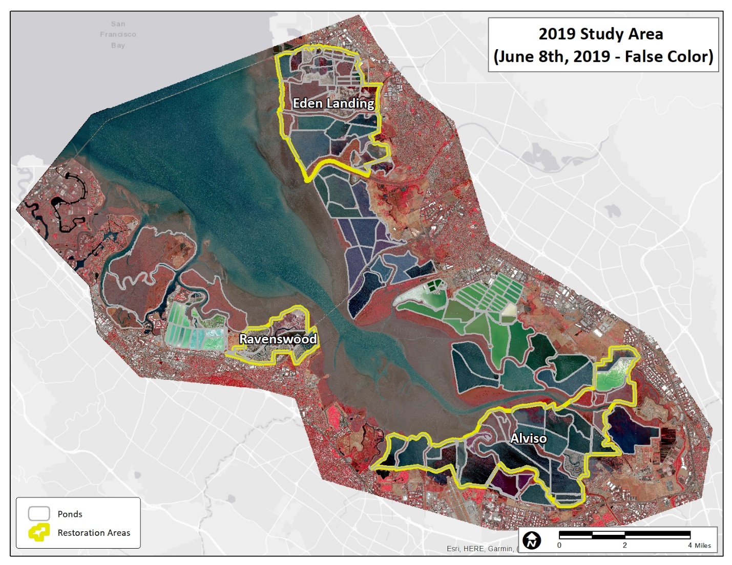
This report outlines the preliminary results of the 2019 update to the original Habitat Evolution Mapping Project (HEMP). HEMP mapped the marshes and mudflats south of the San Mateo bridge yearly between 2009 and 2011. This update to that project (which we refer to as “HEMP2”), is a two-year project designed to understand the current status of these habitats, and to map and quantify the changes over the last decade. Originally planned for 2019 and 2020, the second year of HEMP2, was moved to 2021 and is now underway. The goal of the update is to better inform the South Bay Salt Pond Restoration Project (SBSP), its partners and stakeholders, about the status of marsh and mudflat habitats within the study area and to assess changes to these habitats since the first study a decade ago.
The preliminary datasets produced from the HEMP2 study, and presented in this report, provide the SBSP Project Management Team (PMT) important resources for quantifying and visualizing the current distribution and extent of tidally influenced salt, brackish and freshwater marshes, as well as tidal mudflats, within the study area (See Figure 1). In combination with the results from the first phase of HEMP (Fulfrost, B., Thomson, D., 2012), they also allow the PMT and its’ partners and stakeholders to better understand how tidal marshes have evolved over the last decade (2009-2019). We cannot assess changes to mudflats for this same period since we were unable to use the mudflat data from the previous report as a good baseline. However, we do now have mudflat distribution and extent from 2016 (Fulfrost, B., 2017), and we applied these same methods to the 2019 imagery.
Overall, vegetation communities within tidal marshes have remained relatively stable, especially within fringe marshes along sloughs and marshes that already are well established. Based on our preliminary acreage tables for the entire study area (see Figure 3), there has been a small increase in the acreage of low salt marsh and a subsequent small decrease in the “mid” marsh plain. At the same time there also appears to be an overall increase in brackish marsh, especially in the Alviso area (and adjacent marshes). These overall trends could be variability across years, differences in the application of methods, or even some stochastic combination of factors.
Within the restored ponds, the trends and changes are much easier to understand (and quantify). Within several restored ponds there has been a significant increase in floral colonization (e.g. E9/E8A, A21, A20, North Creek marsh), but not as much in others (A6 & A17). The ponds with less floral colonization have changed into large mudflats, where biofilm also predominates. In some locations, such as the Alviso restoration unit, there also appears to be an in increase in brackish marsh since 2009-211. It is unclear whether this is interannual variability or a potential general shift in salinity.
Overall, the tidal mudflats directly facing the bay (i.e. not within ponds or sloughs) south of the San Mateo appear to be relatively unchanged from 2016. The contour of MLLW provided by the USGS from 2005 (Jaffee, B. & Foxgrover, A., 2006), also shows a general spatial correspondence with the current extent. Although tidal mudflats directly exposed to the bay remain relatively unchanged since 2016 (and even 2015), there are some locations with evidence of accretion and/or erosion. Although it is to be expected, there is also a decrease of mudflats within restored ponds with floral colonization.