Meeting Type
Description
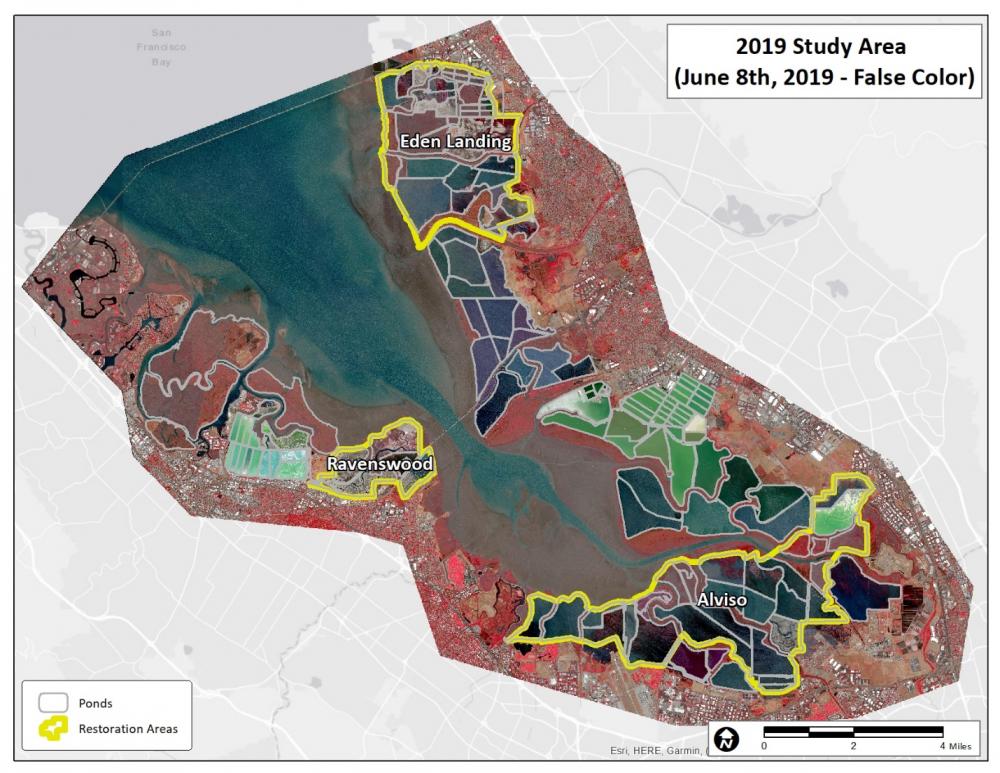
Project consulting scientist Brian Fulfrost of Brian Fulfrost & Associates shared information on his latest effort to use satellite imagery to map South Bay habitats. His background information on the project:
The Habitat Evolution Mapping Project (HEMP) is an effort to assist the South Bay Salt Pond Restoration Project by mapping and monitoring the extent and distribution of tidal marshes and mudflats using semi-automated classification of high-resolution satellite imagery. The tidal marshes and mudflats south of the San Mateo bridge were first mapped on a yearly basis between 2009 and 2011 using multispectral Ikonos imagery at approximately one meter resolution. A two year update to the original HEMP study (“HEMP2”) began in 2019 to map the same area using satellite imagery from Worldview-2 at half meter resolution, and we are now mapping the same area again in 2021. We used supervised classification and extensive groundtruthing as the core method to map dominant vegetation types representing salt, brackish and freshwater marshes. We also mapped the full extent and distribution of mud flats using methods developed in 2016. We will present our preliminary results for 2019 for salt, brackish, and freshwater marshes, and mudflats. Preliminary results exploring changes between 2009-11 and 2019 will also be presented. In addition, plans for data (and imagery) accessibility for restoration partners and stakeholders will also be discussed. Our final report is planned for Summer of 2022.