
Musings on Watersheds
One of my goals in 2022 (only partially satisfied) has been to remember to notice and appreciate the things that are mundane and common but that are impressive, important, beautiful, or just cool to think about.
In that latter category is the concept of a watershed.
Every time I go to the Sierra Nevada, I notice the grand divides between watersheds. It’s hard not to notice when you’ve driven over Donner Pass or Echo Summit, for example. And when I’m hiking in Yosemite, I can’t avoid feeling every step up and over Donahue Pass and out of the Tuolumne River drainage. It is neat-beyond-neat to be way up in the mountains and reflect on the different paths that waters take on one side of a ridge or the other – what the fate of a drop of water might be, what kinds of plants will take it up, what kinds of rocks it will erode, and what body of water – if any! – it will eventually flow into.
Here in the Bay Area, of course, it’s a little less obvious when you are leaving one watershed and entering another. Our local mountains are not as tall, and many ridgelines are less well defined. The waterways themselves are highly modified, and the streams are often underground or in channels, so we don’t always notice it or think much about it. Certainly, on the west side of the Bay – on the Peninsula, for example – it’s fairly obvious when you cross Skyline Boulevard and note that there are huge redwood trees on one side of the road and oak-chaparral woodlands on the other.
But the shifts between, say, the Moraga Creek and Las Trampas Creek drainages are less clear.
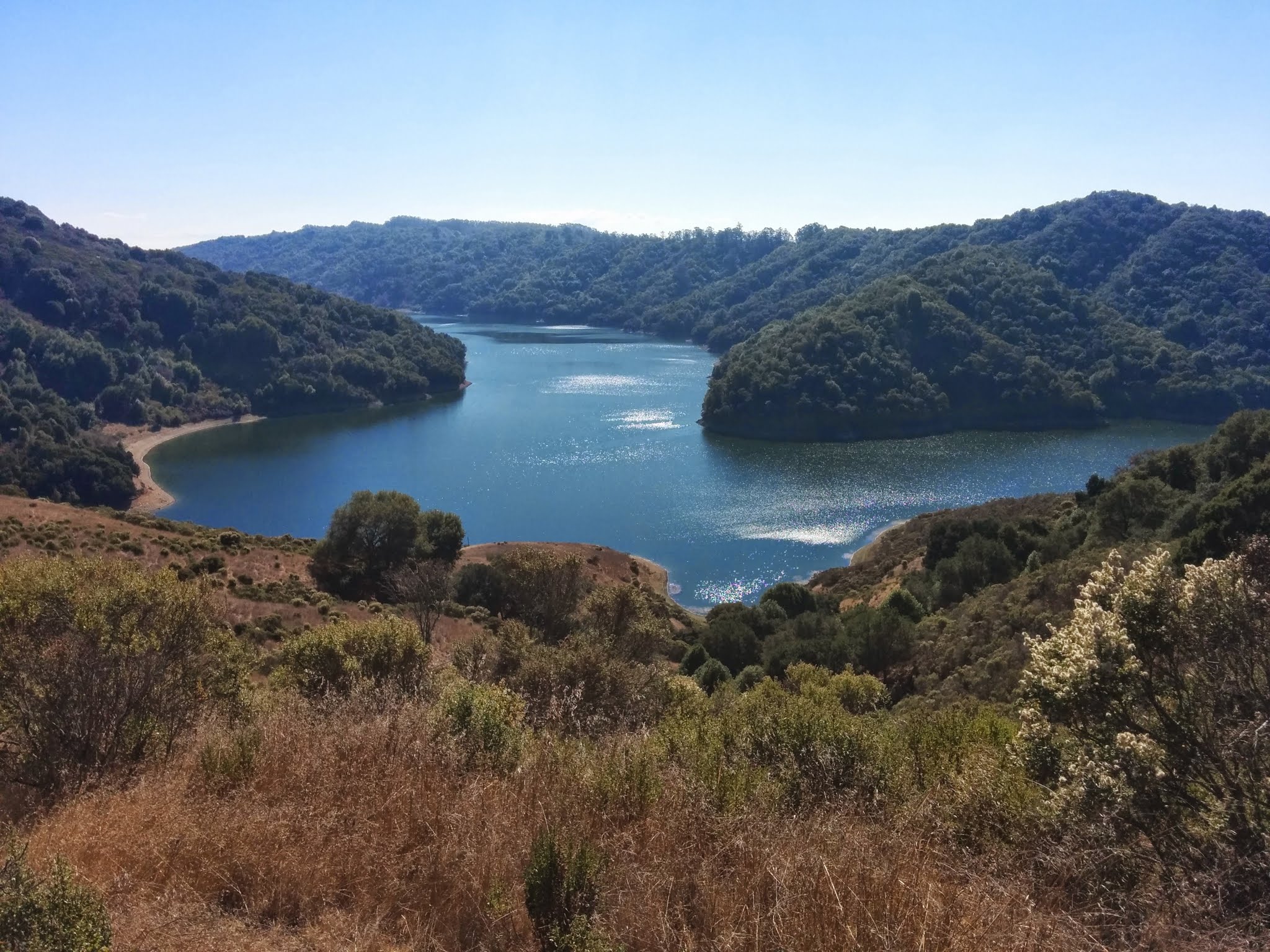
Moraga Creek’s headwaters begin east of the Berkeley Hills in Orinda. The creek flows largely west-southwest and goes into and through reservoirs that are part of the East Bay Municipal Utility District’s local water supply. It meanders through parts of the East Bay Regional Park District’s portfolio of recreational assets before continuing west through San Leandro and Oakland and meeting San Leandro Bay near Oakland Airport. It’s fairly straightforward. But Las Trampas Creek – just a few hundred yards away and over the hilltop home of the Geissberger Observatory at St. Mary’s College in Moraga – flows east-northeast and meanders all over the eastern side of the hills before going underground below downtown Walnut Creek and eventually meeting the eponymous creek itself, as it flows straight north into Suisun Bay.
I know this sounds kind of like a late-night college dorm room conversation, man*, but I still like it. I think it’s important to remain conscious of the underlying natural terrain that we occupy, and I want to pause now and then to reflect on where waters flow and what grows where and why.
*This is the closest I’m coming to a joke in this one.