Meeting Type
Description
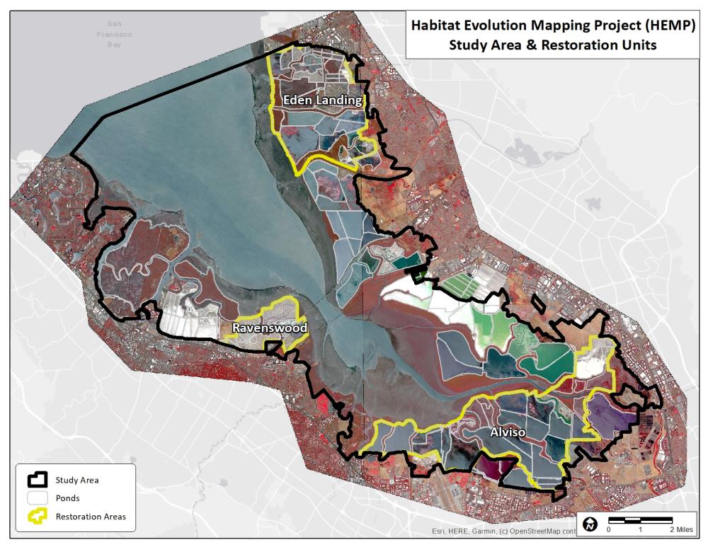
As part of its Adaptive Management Plan, the South Bay Salt Pond Restoration Project tracks habitat evolution and change in South San Francisco Bay, with particular focus on changes to marsh vegetation and mudflat acreages. This work to map baylands habitats south of the San Mateo Bridge via classification of high-resolution satellite imagery and groundtruthing has been undertaken as the Habitat Evolution Mapping Project (HEMP) by Brian Fulfrost of Fulfrost & Associates, first in 2009-2011 (HEMP1) and again in 2019 and 2021 (HEMP2). On December 16, 2022, Brian presented on the final results of the HEMP2 decadal update, which maps and quantifies habitat changes over the last decade and describes the current status of these marsh and mudflat habitats. Overall, the recent work found that overall marsh and mudflat acreages and proportions of habitat types appeared relatively stable between the two study periods. A number of restored ponds saw relatively larger growth in marsh vegetation, and some ponds saw significant growth between the two years of HEMP2. Erosion was seen in some areas, including the Whale’s Tail marsh at Eden Landing and at the mouth of Ravenswood Slough. For questions, email Brian Fulfrost at [email protected].
See a video of the presentation.
See and download presentation slides.
Read the final report here.
See our data page to directly download the data, under the heading Vegetation and Biofilm Data.
| Attachment | Size |
|---|---|
| Presentation Flyer (823.4 KB) | 823.4 KB |